ABADÍN NATURE
MANCOMUNIDADE
NATURE
Among the abundant leisure activities hiking on the many trails and roads of the municipalitys stands; the coastal route of the Way of St. James also passes through Abadín. In the field of crafts the most typical are the quilts and woven blankets, the work of metals also stands. In the tourism aspect, in this council we can highlight the great landscape and ecological potential of the Cadramón and Xistral mountain ranges, which are protected nature reserves, bringing the best conditions for hiking and green tourism in general. You can also go fishing in the Támoga or hunting in Neda Corda. There is a recreational area in Gontán, another in Moncelos and another in Arnela-Catromaior, where you can spend a quiet day in contact with nature. Fraga Vella is also worth visiting. Regarding routes, in addition to hiking, it should be noted the northern route of the Way of St. James, which penetrates from Mondoñedo by Samordás, and runs paralel to the N-634 to Abadín and from there until Mariñán-Villalba.


Take a walk

It is the shortest route of the network of trails of A Terra Chá with only 5.7 km that run through the inside of a “fraga” (forest), uniting in its route five water mills built along the river Fraga. It has a linear path that starts in the Lugar da Laxe, next to the restored Corvite mill. In this stretch the path runs parallel to the Anllo river, covered by a riparian forest. Then it crosses the road and runs along an old wagon road that serviced the intense activity developed in this small river

Ruta PR-G 152 - Ruta dos Muiños
- Duration – 1-2 Hours
- Length – 5,7 Km.
- Difficulty – Medium

We enter A Terra Chá, a region from Lugo which, as its Galician name suggests, is characterized by a packed flat grassland path. We leave Abadín next to the post office and continue along a track, wide enough, to take a path that goes at right hand between oaks and crosses a wooden bridge. A short climb takes us back to a paved track with long straights that will alternate with some shadier paths up to Martiñán, where we cross the N-634. Later we pass Pontevella of Martiñán, the first of the bridges characteristic of the Terra Chá.
- Duration – 12-15 horas entire stretch
- Length – 22 Km.
- Difficulty – Medium
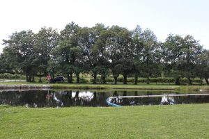
The Gontán recreational area is located on the banks of the river Labrada passing through the center of Gontán. It has a picnic area and a river beach equipped with an cement esplanade to facilitate bathing. It is framed in an environment of riparian vegetation, oaks, birches, alders and willows, among other trees.
- Duration – Spend the day
- Recreational Area
- Restaurant Nearby
The intense wind harnessing in this small mountain range interposed between the Cantabrian coast and the interior of A Terra Chá betrays the constant presence of wind. Including the “xistra”, the wet and icy wind that sweeps the peaks here, some of them only bare rock.
The northern massif is formed by O Xistral with the highest point in O Cadramón (1,062 m), the mountains of A Toxiza (832 m) and A Carba (908 m).

- Duration – Spend the day
- Natural Space
- Restaurant Nearby